After exploring the Monterey Bay Area and aquarium, we’re headed off towards Highway One. It should prove to be an interesting journey to say the least, as a large portion of Big Sur is currently on fire. Though the park is closed, the road remains open, and hopefully we can find some sections of the coast still worth exploring. The smoke from the fire appears to be blowing east at the moment, meaning we may have a clear view of the coast and the ocean, but that could change any minute. Enormous clouds hang in the sky, at least they appear to be clouds, until you get close enough to really see them. They have an odd hue, almost orange and tan, because they’re not really clouds. It’s smoke from the fire, rising miles into the sky as it drifts away from the blaze. As we get closer everything is bathed in a soft orange glow, it’s rather unsettling actually. More updates to come.
Continue reading Travel Updates Day 26: 4PM Pacific

Death Valley
The largest National Park in the lower forty eight states, the hottest and driest place in the country, the second lowest point in the Western Hemisphere. Death Valley is all of this and infinitely more, it has unique species evolved to suit it’s extreme desert environment, golden mountains line it’s horizon, and gargantuan sand dunes fill the valleys. Above all though, Death Valley is dangerous. Previously claiming an average of three fatalities annually, in recent years it’s gotten as high as sixteen. Though the heat isn’t the primary cause for death in the valley (it’s actually single car accidents), it still definitely plays a factor. Anyone who attempts hiking in the valley will immediately understand how dangerous it really is, and how quickly the heat can destroy you.
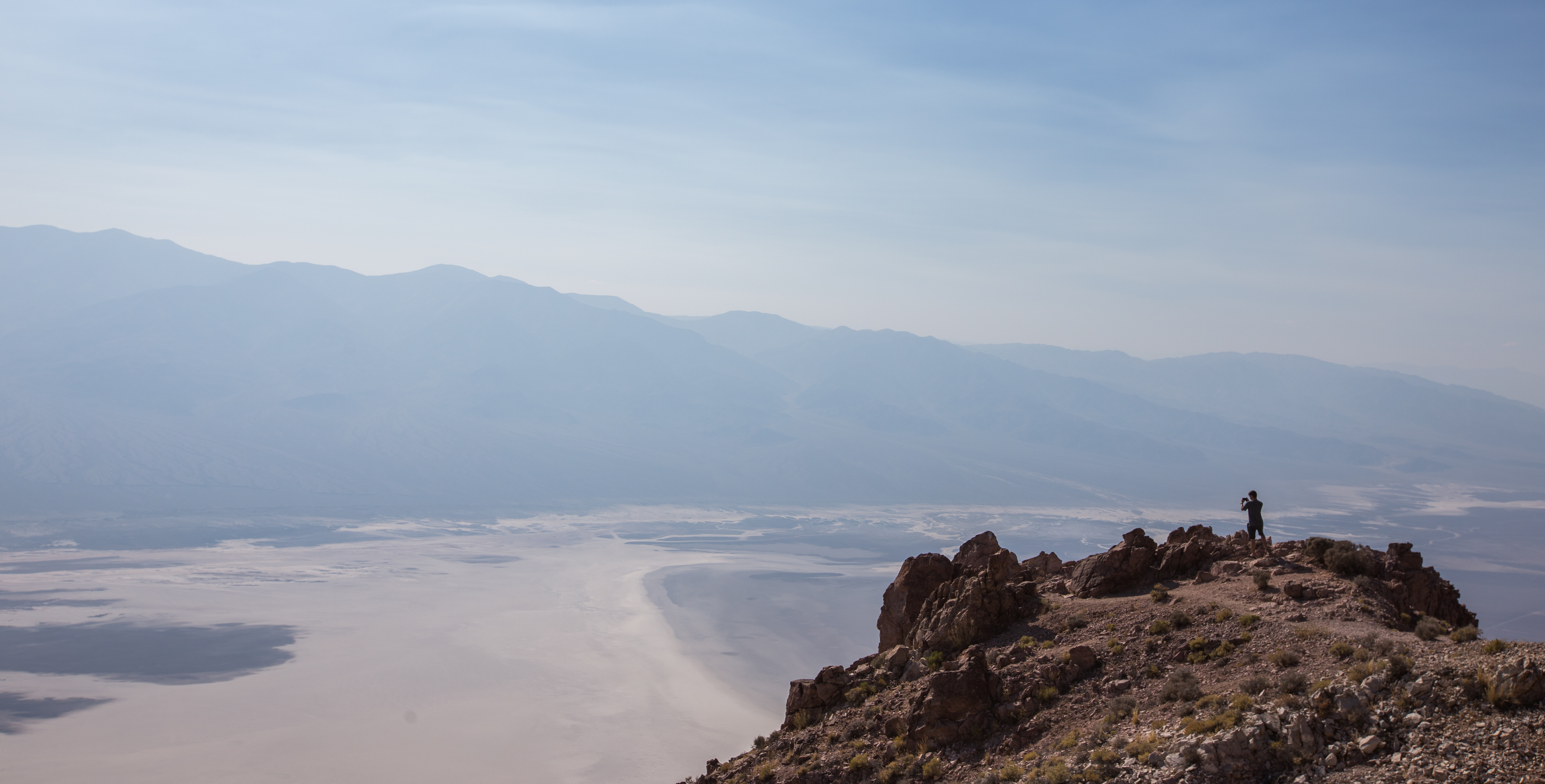
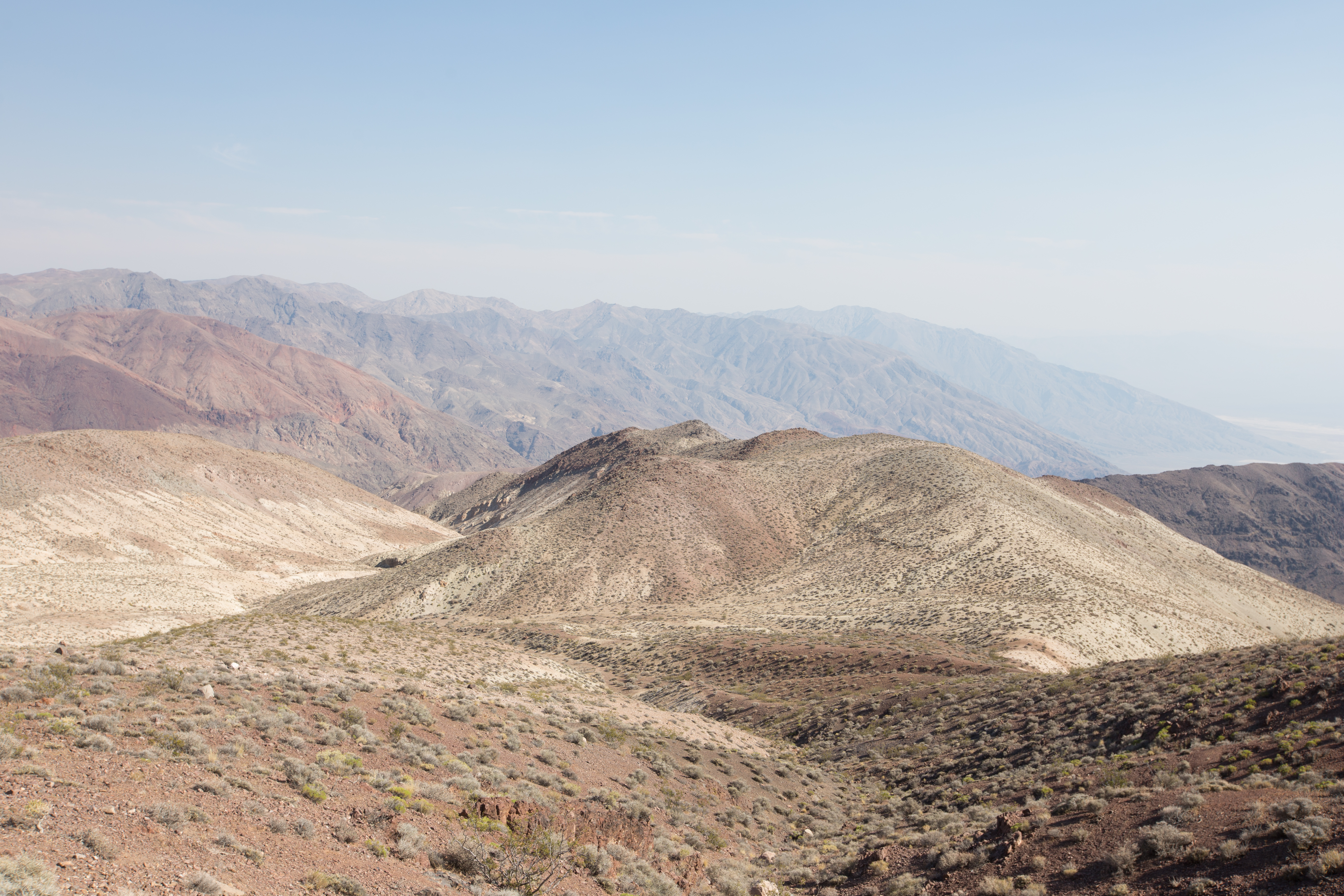
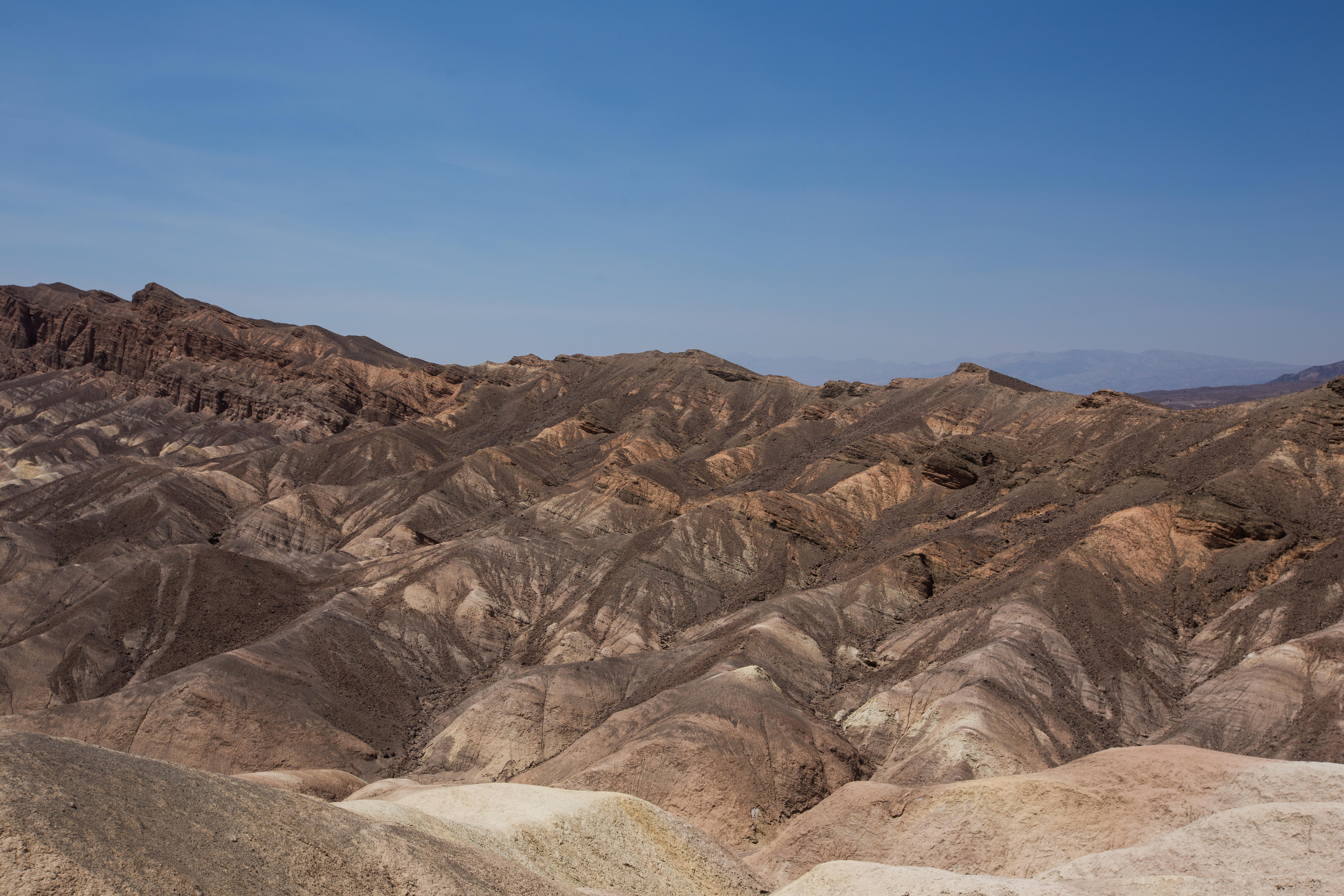
That being said, like all of them, Death Valley is a National Park for a reason. It’s an amazing place, with some incredible scenery. The best times to come are fall and spring, the winter is better for hiking, but there can be snow on the mountains. Hiking is incredibly risky in the summer, when temperatures can get above one hundred and thirty degrees. Luckily, there are a good number of view points and vistas situated a ways off the road as you drive through the park. Each offers spectacular canyon landscapes, and roadside pull offs help you capture the rest. The first thing you’ll come to if you’re driving in from Vegas is Dante’s View, a lookout about thirteen miles down a side road with some mind blowing scenery. Overlooking the Badwater Basin from six thousand feet, the jagged peaks of the Amargosa mountain range rise up all around you as you climb fifteen degree grades up into the sky. At the peak, you can look down into the basin, almost three hundred feet below sea level, with the Panamint mountains towering behind it. A fifteen minute hike up a dirt path behind the parking lot will take you up the summit of the mountain to a death defying overlook which juts out into the canyon. After climbing the ledge of the peak, less than a foot of loose gravel away from a six thousand foot drop, you’ll come to a thin strip of land bridge which leads fifty feet out to a jagged crown of dirty brown rock. The view is amazing, well worth the short hike up, however be warned; you’ll no doubt see the signs warning of this phenomenon, but the area is infested with thousands of bees. Enough of them to be classified as a “hazard” by the local variety of road sign.
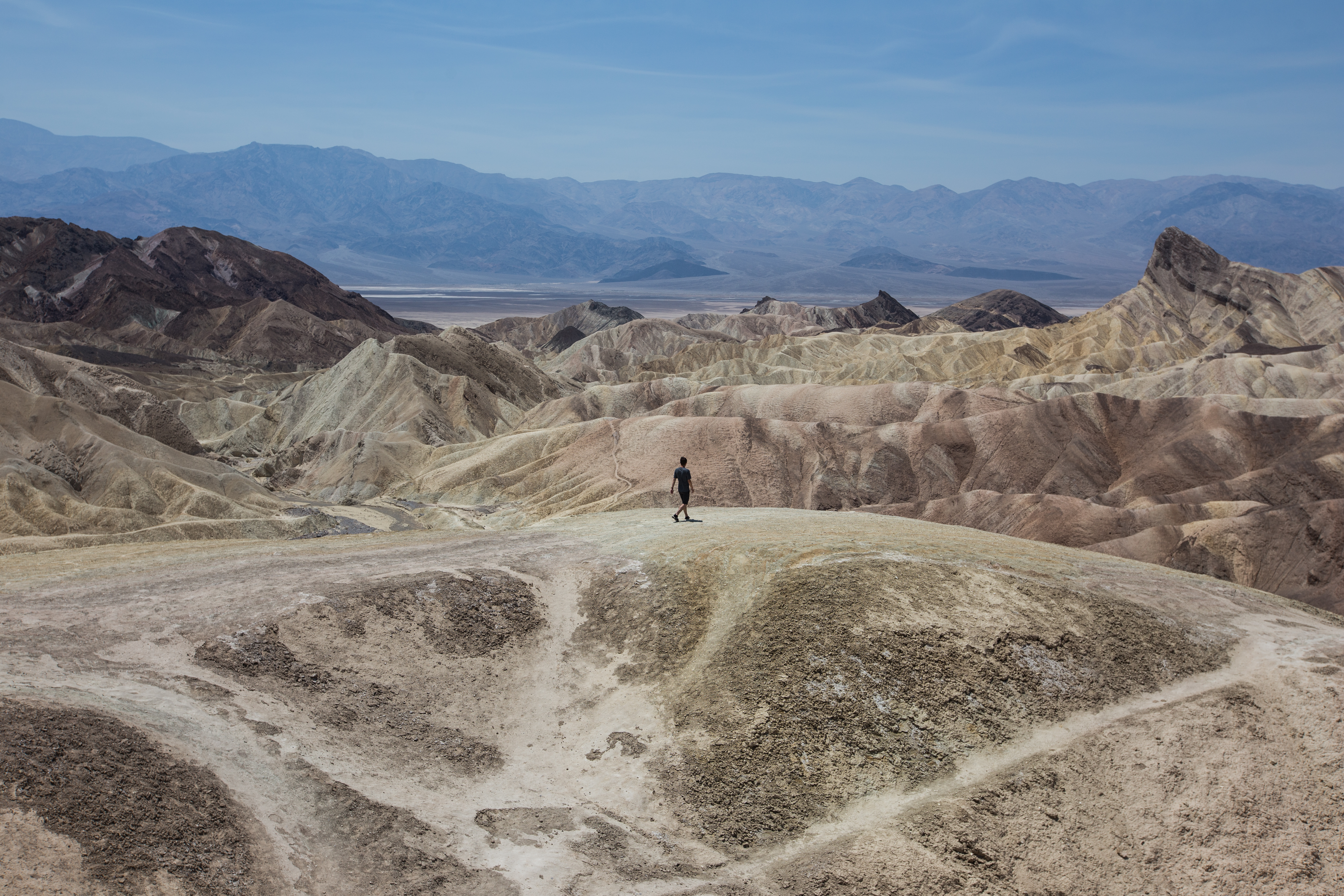
Continuing on, you’ll pass the Golden Canyon, and some of the painted hills. The rock takes on a unique hue, metallic and reflective, it gleams golden bronze in the blistering sun. Mountains of shining gold jut out of the ground just off the road, the majority of their formidable size hidden underground, like a low floating iceberg. Further down the mountains begin to split into bands of brilliant color. Deep reds and bright oranges, yellow and turquoise, shades of blue and purple, as confusing as it is majestic. It’s like someone used the valley as a pallet, indecisively laying down swathes of color, trying to decide which would best suit the canyons. Stovepipe formations start to crop up, like lonely hoodoos they stick to the walls, cylindrical stacks of stone painted a sickly green, almost resembling patinated copper. Off in the distance the rolling sands of the valley’s many dunes can be seen lighting up on the horizon. Their glossy faces picking up the sun, throwing it back across the canyons and glinting a golden yellow.
There’s tons to see out in Death Valley just from the road, but if you really want to experience it, hiking is a must. That being said, it’s incredibly dangerous, and even if you don’t die, the heat can still incur brain damage and other maladies that are basically just terrible. They recommend each person bring at least a gallon of water, and that’s if you’re not hiking. The other thing to keep in mind is that the physical exertion will also rob your body of electrolytes, which you need to keep balanced with the amount of water you’re drinking. This isn’t usually a problem if you’re not hiking, but if you are, that imbalance can get bad quick if water is all you have. The amount you need to drink just to stay cool is way over the norm, and you’ll end up in bad shape unless you bring something to replenish electrolytes too, Gatorade should do the trick.
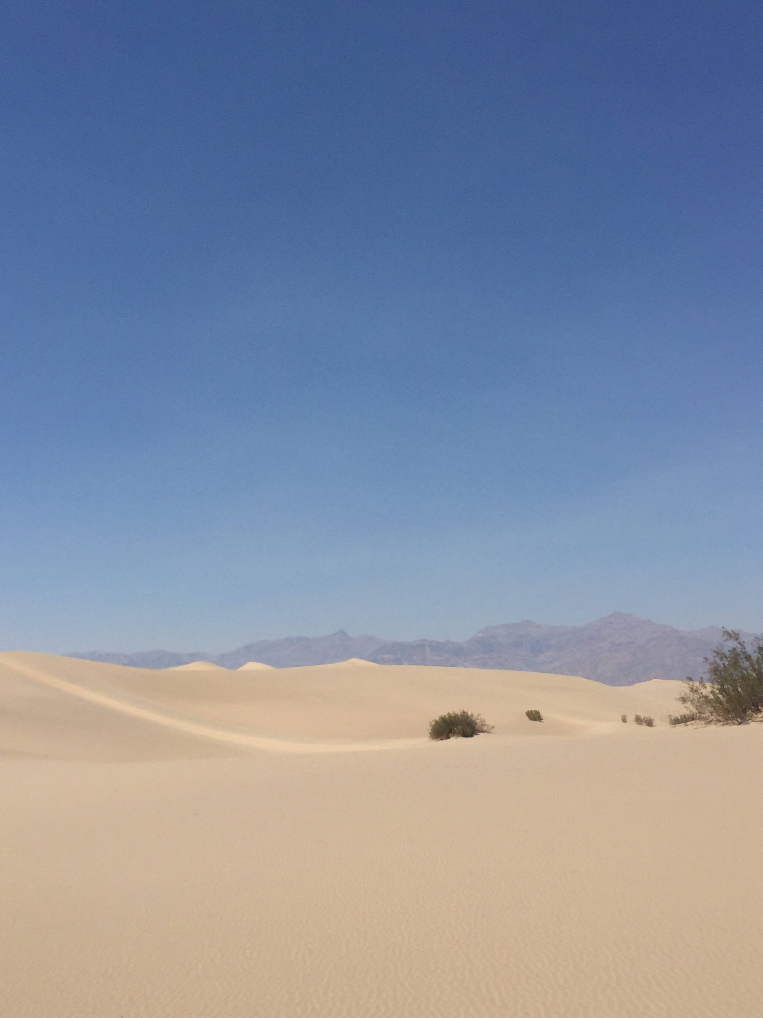
Moving on we arrived at the Mesquite Flat Sand Dunes, and it was almost one hundred and twenty degrees out. Andrew didn’t think he could make the hike due to the unreal conditions, so at this point I struck out alone into the dunes. Intending to conquer the peak of the dunes, which was about one and three quarter miles out from the road, I geared up with two full canteens and set out towards my goal. It was one of the most difficult things I’ve ever done in my entire life. After walking for about five minutes I made it to the first dune, and upon crossing it, realized exactly how large the desert I was facing really was. The dune sloped gently down for at least a hundred feet, and by the time I reached the bottom the outside world had disappeared completely. All I could see was sand, in every direction. No matter which way I looked I was surrounded by dunes, lifeless and desolate, they stretched off into the distance for miles, the road lost far behind me. Where it not for the mountains just off the horizon, I might as well have been in the Sahara.
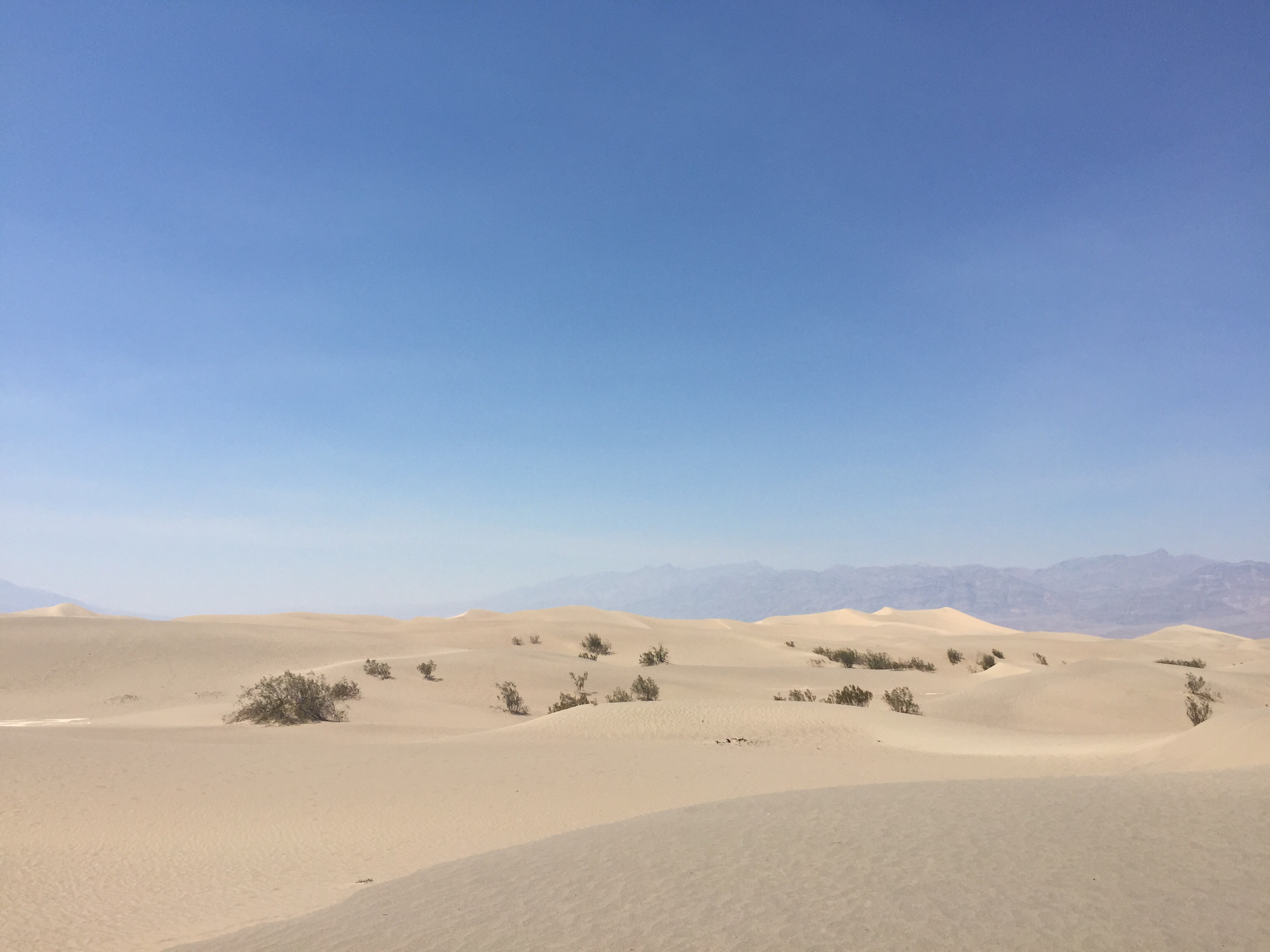
The journey to the central dune was amazing, the feeling of being lost in the desert, the grandeur of the shifting sand, it’s the stuff adventure is made of. Part of the reason I came out here at all was for this, some real high desert adventure, to be completely enveloped in the most intense landscapes North America has to offer, and boy did I get what I came for. No other hikers had dared attempt it, I was totally alone in the desert, and it was one of the most beautiful places I’ve ever been. Sweatier than I’ve ever been, I walked across the seemingly endless dunes with a solemn determination to reach my mark. The heat didn’t even seem so bad, I was lost in a sea of gold, guided by glimpses of sandy peaks towering hundreds of feet into the blue sky above me. The sand bunched up beneath my feet, each step disturbing it’s gleaming tranquil surface. The occasional shrub dotted the landscape, all of them about one strong gust away from becoming a tumbleweed, their dried husks clinging desperately to the boiling dunes. Finally, I made it to the central dune and began my ascent.

(It looks way smaller than it really isn’t. That’s about 200 feet.)
It was grueling. The sand is much lighter and looser than any dunes I’ve encountered before. Each step up creates a miniature sand slide, a few feet of the wall falling away beneath you as you disturb it from its restful tanning session. It’s like trying to climb a treadmill made of jello at more than sixty degrees of incline. The sand falls down over your feet, burying them in the side of the slope with each movement, holding them hostage with tremendous pressure. I was already exhausted halfway up, but the sand was at least three hundred degrees, if you stopped for more than a few seconds it would literally start to burn your skin. As I neared the top it got so steep I was forced to crawl the last fifty feet, burning my forearms as I went. Finally I made it to the peak, exhausted and overheating, I looked out onto the desert below, at the rolling sand and glistening valleys. Hiking along the ridge of the dune, I might as well have been leading a team of camels, the heat beating down on me as I deleriously snapped as many photos as I could, my hands still shaking from the climb. It was now that I realized the danger I was truly in. My core temperature had risen from the strenuous climb up, but now I couldn’t cool back down, and was essentially stuck in overdrive as I prepared for the journey back.
As I stepped back off the ridge I felt the ground give way beneath me, as my downward momentum triggered a massive sand slide which sent me gliding casually down the entire face of the dune. Reaching the bottom, I oriented myself, bracing for the journey ahead. At this point I still had an entire canteen left, but no matter how much I drank I couldn’t cool down, I could feel my body getting weaker as I trudged through the sand, following my foot prints back towards the relative safety of the road. It was on this, the return journey that I understood why so many die attempting to do just this, why I was the only hiker for miles around. About halfway back I started to feel chills, a sign of pending heat stroke, and I couldn’t help but wonder if I had made a mistake in attempting the hike. Realizing the danger I would be in if I didn’t find a way to cool down, I took a risk and poured half of the remaining canteen over my head, a move that might have saved my life, as it allowed me to shed some of the heat I’d built up during the climb. Even so, it got harder and harder to keep going, near the halfway point I could feel my extremities going numb, the chill in my arms and legs was constant, and I could sense nausea coming on as well. There was a single thought in my mind at that point, making it back. Though the beauty of the desert was far from lost on me, whatever innocence it may have had was long gone. Death Valley seemed an ever more appropriate monicker as I climbed through the dunes, drenched in sweat and reveling in the sense of the adventure. Perhaps it was delerium, but even though I never stopped focusing on making it back in one semi-hydrated piece, I couldn’t help but enjoy even this, the return trip. I’ve never been so close to collapsing in my entire life, never had to push myself so hard just to move, but the sense of accomplishment, the feeling of being alone in such a spectacular environment, it’s one of the greatest adventures I’ve ever been on.
As is obvious, I made it back in one piece, safe, sound, and coated in really sweaty sand. Even though I played it safe, took plenty of water, made sure to stay in sightline of the road when possible, and paced myself accordingly, I still got lucky. Had I spent much more time out there, you could be reading a very different story right now. Under no circumstances should you underestimate Death Valley, the heat is no joke, and hiking in the dead of summer is incredibly risky. Make sure you take tons of water, protein, and something to replenish electrolytes. Make sure someone knows where you are and when you plan to be there. Know your route and your limits before even thinking about tackling these hikes, and be cautious what you take. Heavy gear can weigh you down and make any hike that much more strenuous, and out in the valley ten minutes can be the difference between life and death. Just recently a French couple died attempting to hike in the desert, they underestimated the heat and paid the ultimate price for it. This isn’t meant to dissuade you though, only to serve as a cautionary advisement. Death Valley is still a National Park, and it’s acquired such a prestigious designation for very good reasons. It’s a spectacular place, with gorgeous canyons of gold, miles of rippling dunes, brilliantly painted mountains, and unbelievable salt flats. It’s one of the most raw places I’ve ever encountered, it’s pure and savage, the perfect place for a real adventure.
Travel Updates Day 25: 6PM Pacific
6AM Pacific:
We’re just now leaving Vegas, after three days of actual vacation we somehow managed to squeeze into our trip. It’s already closing on a hundred degrees, the temperature never drops too far below it. The haze from the Californian forest fires is dying down, and the mountains have finally made themselves apparent on the horizon. It promises to be a long day as we head towards Monterey, normally not a terrible drive, except we’re going through Yosemite on our journey west. More updates to come.
Continue reading Travel Updates Day 25: 6PM Pacific
Travel Updates Day 23: 2PM Pacific
2PM Pacific:
Only have a few minutes to write, found a single square foot of service in Death Valley. It’s hot. It’s so incredibly hot. Temperatures up to 130? Definitely. It’s like living in a blow drier. More updates to come.
Side update: Now 100 feet below sea level. It’s 115

Travel Updates Day 22: 2PM Pacific
2PM Pacific:
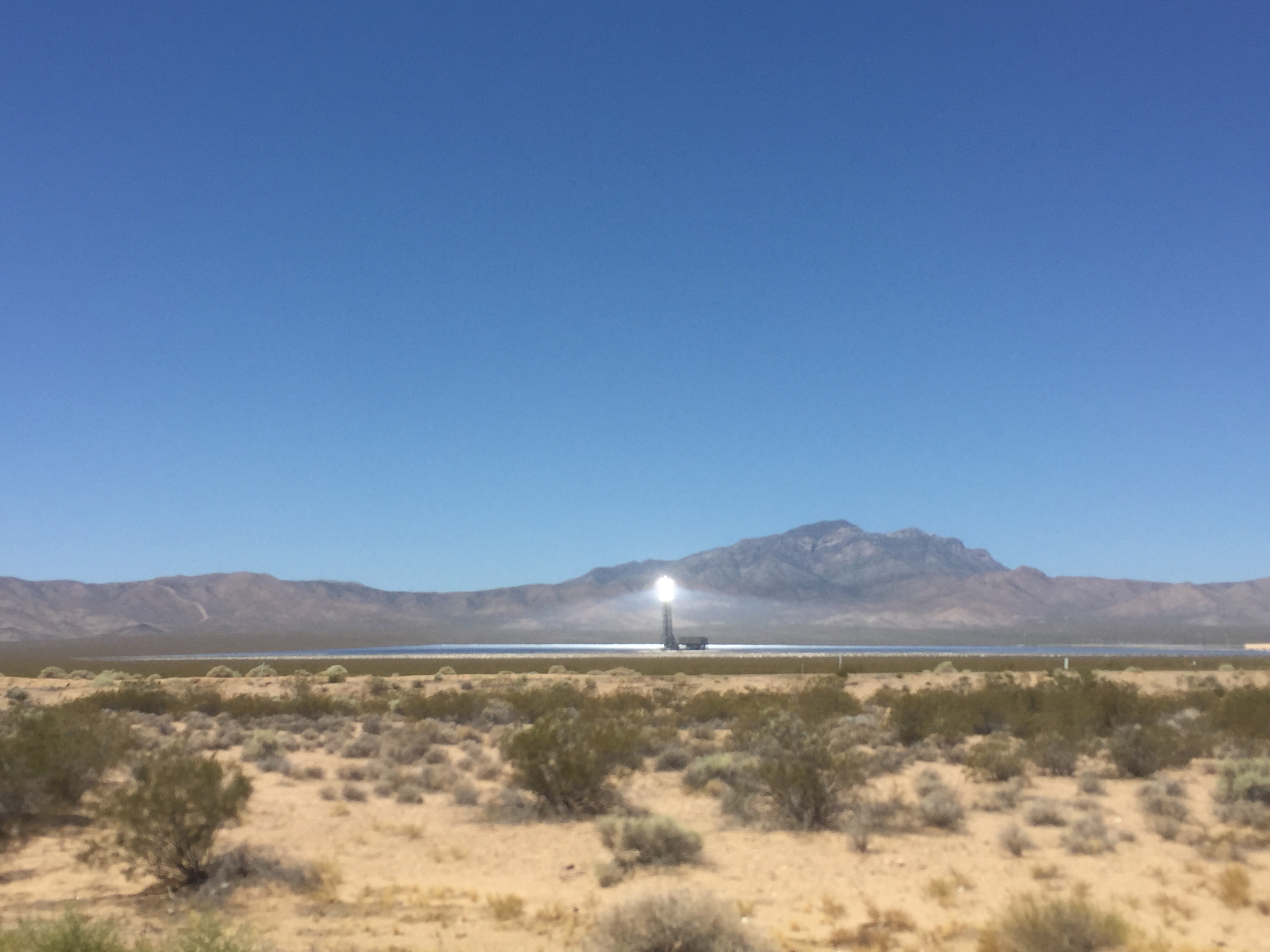
We struck out to explore the Mojave this morning, but much to our surprise were greeted with what appeared to be a heavy fog covering the entire area. Visibility was fine up until about a mile out, where it just dropped off completely. Everything past that point became a confused haze of blue and tan, entire mountains disappearing into the background, the sands of the desert just sort of, ending. We later learned that this was an incredibly unusual phenomenon, one which the ranger we asked had never seen before in his life. Apparently, the massive forest fires happening in Southern California right now have created a enormous smog cloud, which has moved over us since yesterday morning. Unperturbed, we continued into the Mojave and climbed the Kelso Dunes before heading back north towards Vegas. The haze has lightened since then, but still hangs over the land for considerable distance. Visibility has increased to maybe two or three miles, but past that all you can see is a wall of light grey, with tan towards the bottom. More updates to come.

Travel Updates Day 21: 3PM Pacific
11AM Pacific:
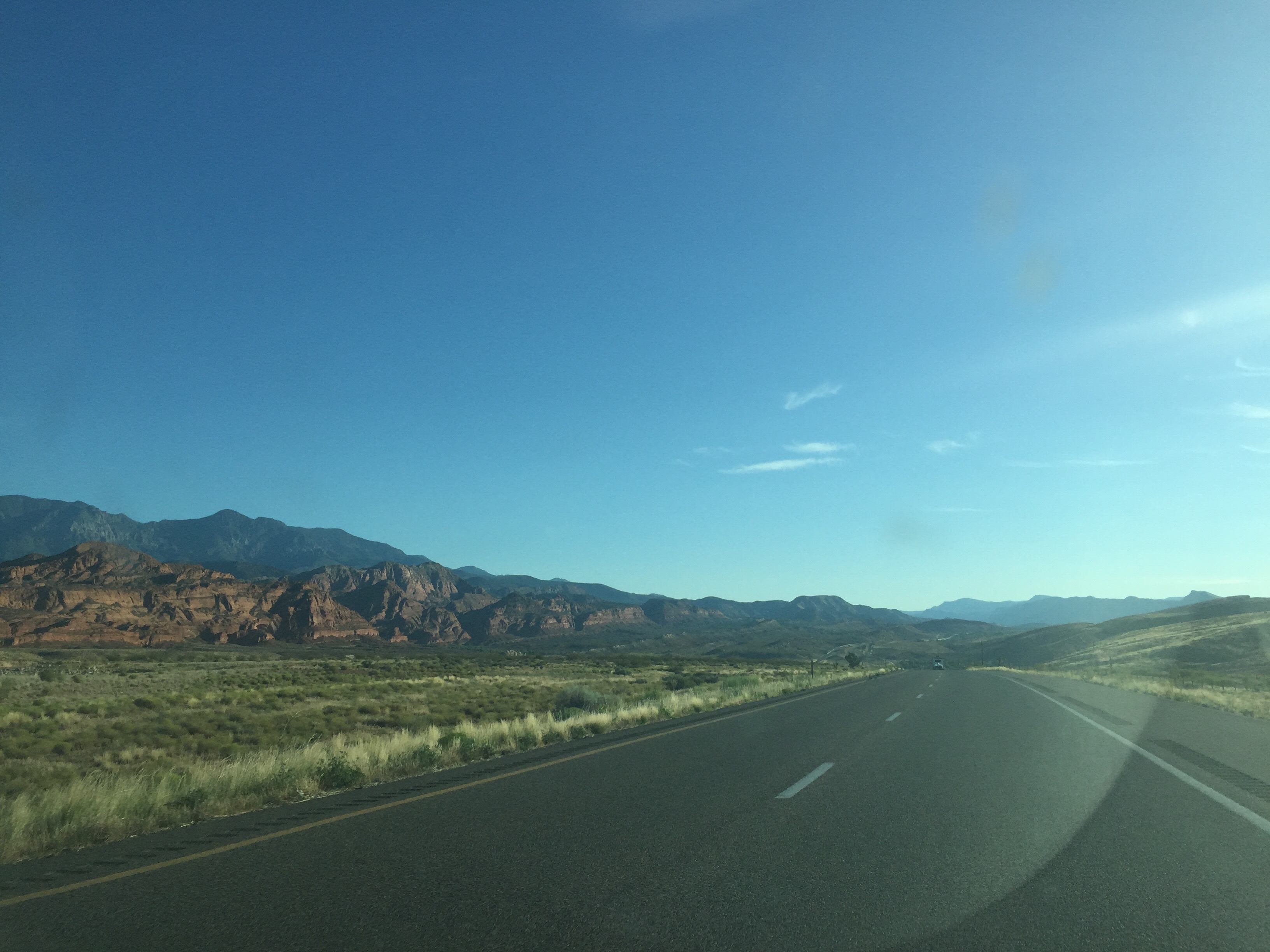
We’ve left Utah and made it to Vegas. However were not ready to go broke quite yet. We’re driving through the city on our way to Primm, and spending the day out exploring the high desert. The promise of a mojave ghost town has us driving south into the desert, where its already almost one hundred degrees, and rising. The various mountain ranges which border the desert form a great bowl around the sands, which lay flat out to the horizon. A layer of green coats the yellow, a blend of some two thousand unique plant species which call it home. Getting sunburned through the windows. More updates to come.
Continue reading Travel Updates Day 21: 3PM Pacific

Zion National Park
Zion National Park is the pinnacle of Southern Utah. Two hundred and twenty nine square miles of canyons, arches, mesas, slots, and formations, unlike anything else in the world. Resting on the point where the Mojave, Great Basin, and Colorado Plateau slam together, Zion is the twisted byproduct of an all out tectonic war. Albeit a gradual one. The elements have carved through the Navajo Sandstone with a humbling force, and left in their wake one of the most majestic landscapes in the world. Over four hundred unique species of animal, countless plants and insects found only in the canyon, all the result of one hundred and fifty million years of sedimentation.
Continue reading Zion National Park
Travel Updates Day 19: 3PM Mountain
8AM Mountain:
Hello all and welcome back, apologies for the sparse content of late, the lack of service has been plaguing this trip from the start. Turns out most camp sites and national parks don’t have wifi, go figure. Today we’re on our way to Grand Staircase, with plans to hike Zebra Slot Canyon, and possibly the flooded Tunnel Slot Canyon. The heat is real once again, set to reach over one hundred by noon. As amazing as it is this desert it truly brutal, we’ve been rigged with water bottles and canteens for days now. That being said, if we weren’t we’d surely be laying in a crusty pile off the side of a trail somewhere. The sky is its usual dusty haze of blue, sliding in over the brilliant red sandstone cliffs to obscure their details from view. The desert foliage covers the tops of the mesas, the red and green becoming indistinguishable in some places, creating something of a confusing tan shade across the horizon. More updates to come.
Travel Updates Day 17: 10AM Mountain
10AM Mountain:
Unfortunately a lack of cell service still plagues us. Travel updates are only possible in the mornings and evenings now, as the entirety of the afternoons are spent in the canyons. That being said, we’re on our way to the Zion Narrows, with plans to hike three hours up the Virgin River to Wall Street, a famous canyon junction. Thankfully we’ve come on a day with cloud cover, it’s only supposed to reach about ninety degrees, bearable when compared to the blazing high desert. More updates to come.

Arches National Park
The Arches are about seventy seven thousand square acres of sandstone buried in the stomach of Southern Utah. These are however, the most majestic seventy seven thousand square acres anywhere in the western hemisphere. Relatively small in comparison to it’s brothers throughout the country, the park covers a compact area of highly condensed sandstone structures and arches, housing more than two thousand within park limits. The park is open all day every day, affording you access to some of the most magnificent sunsets and milky-way panoramas anywhere in the world. The mere concept of the place is staggering, much like the old growth forests of the pacific coast, Arches is a window through time, the remnants of an ancient world whose foundations predate the Jurassic.
